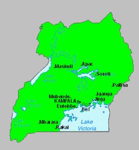
Uganda is situated
in East Africa and is completely landlocked. Click on the map image
for a larger view. Most of the country is a plateau about 1,200m above
sea level. Kampala is the capital city with a population of around
500,000. Airlines operate internationally from Entebbe airport with
regular flights to London which take eight and a half hours. Entebbe
is on the shores of Lake Victoria where water sports of all kinds
take place. There are also some botanic gardens in Entebbe.
Uganda is divided
into seven regions and in each region there are a number of districts.
Uganda covers an area of 241,139 sq km of which 39,459 sq km are swampland
and water. 90% of the population live in the countryside on family
farms called shambas. People usually farm four to five acres in the
coffee growing areas and between eight and nine acres in the cotton
areas.
The young Winston
Churchill called Uganda the loveliest area in Africa and one of the
most striking in the world,.
The highest point
in Uganda is the Margherita Peak at 5,328m which is in the western
region. From a map of Uganda try and find the next three highest mountains.
The United Kingdom's highest mountain is Ben Nevis. How does this
compare with Uganda's highest point?